Northwest India Gripped by Severe Weather Mayhem
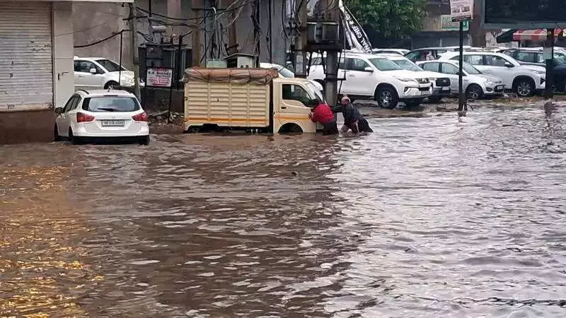
The northwestern region of India, encompassing Punjab, Haryana, and Himachal Pradesh, experienced a night of intense weather disruption on Friday. Residents awoke to a chaotic scene characterized by relentless rainfall, crackling thunderstorms, and sudden bursts of hail that pounded the area through the night.
Widespread Precipitation and Hailstorms
Himachal Pradesh reported widespread rain accompanied by fresh snowfall, adding to the winter landscape. Meanwhile, Punjab, Haryana, and the union territory of Chandigarh witnessed light to moderate showers. Isolated pockets in Punjab were particularly hard-hit by hail, with thunderstorm cells unleashing squally winds that reached a roaring 90 kilometers per hour in parts of Himachal Pradesh and Punjab.
Staggering Rainfall Anomalies Recorded
The intensity of this weather spell is reflected in staggering rainfall anomalies. Punjab logged an unprecedented 1,375% excess rainfall in the past 24 hours, receiving 13.3 millimeters against a normal of 0.9 millimeters. Haryana was not far behind with a 592% excess rain, and Himachal Pradesh registered a 103% excess, effectively doubling its usual precipitation for this period.

In terms of specific rainfall measurements, Gurdaspur led the charts with 40 millimeters, followed by Pathankot at 32 millimeters, Moga with 25 millimeters, Jalandhar at 23 millimeters, Sangrur with 21 millimeters, and Amritsar recording 20 millimeters. In Haryana, Bhiwani collected 15 millimeters, while Kaithal and Kurukshetra saw 10 millimeters each.
High Wind Speeds and Snowfall Accumulation
Wind speeds across Himachal Pradesh's mid- and high-hill zones resembled a winter storm. Narkanda clocked winds at 87 kilometers per hour, followed by Kufri at 67 kilometers per hour, Seobagh at 65 kilometers per hour, Mashobra at 59 kilometers per hour, and Neri at 54 kilometers per hour. In Punjab, Hoshiarpur recorded winds of 61 kilometers per hour, Chandigarh hit 39 kilometers per hour, and Haryana's Rohtak and Karnal reported gusts up to 35 and 33 kilometers per hour respectively.
The snow cover deepened significantly in the upper reaches of Himachal Pradesh. Kothi received 15 centimeters of snow, Gondla saw 12 centimeters, and Kukumseri measured 6.8 centimeters. Fresh layers of snow were reported across Manali, Jot, Keylong, Kufri, Bharmour, and even Shimla, which recorded 0.6 centimeters.
IMD Forecast: Fog, Cold Waves, and More Rain Ahead
According to the India Meteorological Department (IMD), dense fog is expected to make a comeback in pockets of Punjab, Haryana, Chandigarh, and Himachal Pradesh between January 24 and 26. Additionally, cold wave conditions may hit isolated parts of Himachal Pradesh on January 25 and 26.
Another fresh wet spell is lined up for the hills on January 27, with chances of isolated heavy snowfall, followed by scattered precipitation on January 28. Light to moderate rain is also likely in the adjoining plains during this period.
Sharp Thermal Swings Observed
Friday also marked a sharp thermal swing across the region. In Punjab, the average minimum temperature rose by 6.7°C from the previous day, settling at a markedly above-normal 6.4°C. Gurdaspur was the coldest at 8.5°C, but most stations stayed above 10°C, with departures up to 8°C from seasonal norms.
Haryana mirrored this trend with a 6.6°C rise in minimum temperatures within a day, recording temperatures appreciably above normal by 4.8°C. Narnaul posted the state's lowest temperature at 6.5°C, while other districts stayed above 10°C, up to 6.6°C above their seasonal averages.
This severe weather event highlights the dynamic and often unpredictable nature of winter conditions in northwest India, impacting daily life, agriculture, and travel across the affected states.