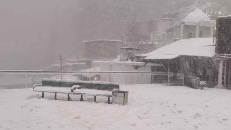
The Kashmir Valley and Pir Panjal regions in Jammu and Kashmir are poised for substantial snowfall beginning early Friday, according to the latest forecast from the India Meteorological Department (IMD) in Srinagar. Meteorological experts indicate that consecutive western disturbances will influence the region's weather patterns for nearly a week, bringing a dramatic shift from the recent arid conditions.
Authorities Heighten Preparedness Amid Forecast
In response to the impending severe weather, local authorities have intensified preparedness measures at the district level. Kulgam Deputy Commissioner Athar Aamir Khan highlighted proactive steps, including the hospitalization of 232 women expected to deliver babies this week. This precautionary measure aims to ensure uninterrupted medical care during the anticipated harsh winter spell, safeguarding maternal and infant health.
From Arid Winter to Snowy Onslaught
Jammu and Kashmir has experienced an unusually dry winter this month, with a rainfall deficit of 96%. This arid period has led to concerning environmental issues, such as forest fires and the drying up of rivers and streams. However, IMD Srinagar Director Mukhtar Ahmad stated on Thursday that weather conditions are set to change dramatically starting early Friday.

Moderate to heavy rainfall and significant snowfall are likely in parts of south Kashmir, while north Kashmir may see moderate to heavy snow accumulation. Ahmad emphasized that this weather shift could disrupt daily life and infrastructure across the region.
Potential Disruptions and Safety Warnings
The IMD has issued warnings about possible traffic disruptions and landslides on major highways due to the snowfall. Key routes at risk include the Srinagar-Leh highway, Mughal Road (which connects the Kashmir Valley to Poonch district in the Jammu division), and Razdan Pass—a high-altitude mountain pass linking north Kashmir's Bandipora district with the Gurez Valley on the Line of Control.
Additionally, Ahmad noted that air traffic could be affected on Friday, with high-altitude areas like Zojila Pass, Gulmarg, and parts of Kupwara expected to receive two to three feet of snowfall. These conditions may lead to flight cancellations or delays, impacting travel plans.
Extended Weather Impact and Agricultural Advisory
With another western disturbance likely to affect the region from January 26, Ahmad advised farmers to postpone agricultural activities until January 28. He detailed that light rain is expected on January 24-25, followed by an active phase commencing from January 26. During this period, moderate rain and snow are anticipated at most places across Kashmir, potentially extending the weather-related challenges.
This series of western disturbances underscores the volatile nature of winter weather in Jammu and Kashmir, prompting authorities and residents to remain vigilant and prepared for the coming days.