Fresh Western Disturbance to Bring Widespread Weather Disruption Across Northern India
According to the latest All India Weather Summary and Forecast Bulletin issued by the India Meteorological Department (IMD), a fresh spell of unsettled weather is poised to grip extensive regions of north, northwest, and central India starting from January 26. This meteorological event is triggered by the approach of a new western disturbance, which will usher in a complex mix of precipitation and atmospheric disturbances including rain, snowfall, hailstorms, thunderstorms, gusty winds, and fluctuating temperatures across the affected areas.
Active Wet Phase to Commence with Peak Intensity on January 27-28
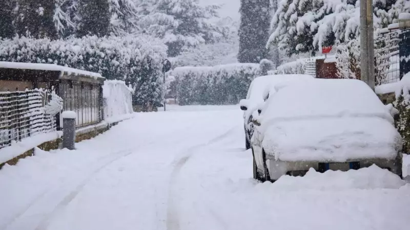
The approaching weather system is expected to initiate an active wet phase across the western Himalayan region and its adjoining plains. The IMD has forecast that the most intense activity will occur on January 27 and 28, with significant weather impacts anticipated throughout this period. The department has issued specific warnings regarding heavy rainfall and snowfall at isolated locations in Jammu and Kashmir, and Himachal Pradesh. Additionally, several hill districts and adjoining plain areas may experience hailstorms, while coastal waters in the far south could encounter squally winds.
Western disturbances represent crucial winter weather phenomena that originate over the Mediterranean region and travel eastward. These systems play a vital role in bringing essential rain and snow to northern India, particularly affecting the Himalayan belt and the expansive Indo-Gangetic plains. The current disturbance is likely to begin influencing northwest India from January 26 onward.

Detailed Weather Forecast for Key Dates
January 26 (Republic Day): Weather conditions are expected to begin deteriorating across multiple regions on Republic Day. Thunderstorms accompanied by lightning are very likely at isolated places over Kerala and Mahe, potentially bringing brief but intense spells of rain along with thunder activity. Dense fog is also anticipated at isolated locations over west Uttar Pradesh, which may affect early morning visibility and disrupt road and rail traffic in parts of the region. Marine conditions are forecast to turn rough as well, with squally weather featuring wind speeds of 40 to 50 kmph, gusting up to 60 kmph, likely over the Gulf of Mannar and the Comorin area. Fishermen have been advised to exercise caution and avoid venturing into these waters during this period.
January 27 (Peak Impact Day): This day is expected to witness the most active weather conditions of the entire spell. Heavy rainfall or snowfall is likely at isolated places over Himachal Pradesh and the Jammu and Kashmir, and Ladakh region. These heavy spells may lead to fresh snow accumulation in higher reaches, potentially affecting road connectivity in mountain passes and triggering localized disruptions in transport and daily life. Thunderstorms accompanied by hailstorms are likely at isolated places over Himachal Pradesh, Jammu and Kashmir, Ladakh, and parts of Uttarakhand. Thunderstorms with lightning and gusty winds reaching 40 to 50 kmph are also expected over Himachal Pradesh, Jammu and Kashmir, Ladakh, and western Uttar Pradesh.
January 28 (Gradual Weakening): By January 28, the intensity of the system is expected to gradually decrease, but unsettled weather will continue in several regions. Thunderstorms accompanied by hailstorms are likely at isolated places over Uttarakhand, while thunderstorms with lightning and gusty winds of 40 to 50 kmph are forecast over west Uttar Pradesh. Rainfall activity is expected to remain fairly widespread to scattered over the Western Himalayan Region and northwest plains, but is likely to decrease thereafter as the western disturbance begins to move away.

Additional Weather Concerns and Travel Advisory
Dense to very dense fog conditions are expected to persist in pockets over Punjab, Haryana and Chandigarh on January 25 and 26, while dense fog is also likely over Himachal Pradesh, sub-Himalayan West Bengal and Sikkim during the same period. Cold wave conditions are likely in isolated pockets over Himachal Pradesh, Punjab, Haryana-Chandigarh and Rajasthan on January 25 and 26. However, no specific dense fog or cold wave warnings have been indicated beyond January 26, suggesting that conditions may improve as the new weather system becomes dominant.
The IMD has issued a travel advisory based on these forecasts. The mountains are expected to receive heavy snowfall and hailstorms, which may affect road connectivity, tourism activities, and horticulture operations. In the plains, thunderstorms, gusty winds, and hail may disrupt transport networks. Fog conditions on January 26 may continue to affect flight schedules, train services, and highway traffic in parts of Uttar Pradesh, Punjab, and Haryana.
This comprehensive weather alert underscores the significant impact that western disturbances can have on India's northern regions during the winter months, affecting everything from daily commutes to agricultural activities across multiple states.