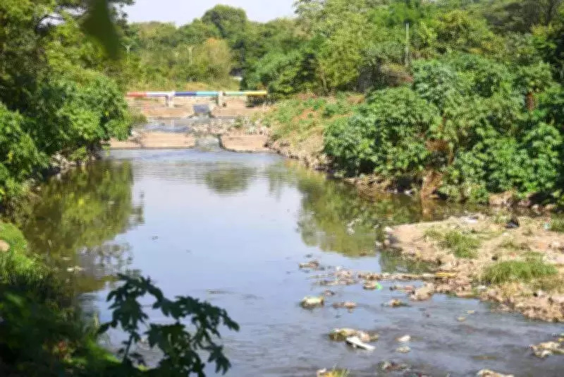
Kham River in Chhatrapati Sambhajinagar to Receive Blue and Red Regulatory Flood Zone Markers
In a significant move for urban flood management, the Kham River flowing through Chhatrapati Sambhajinagar is set to receive official blue and red lines as regulatory flood zone markers. This development comes as part of a comprehensive river rejuvenation project aimed at enhancing the city's resilience during monsoon seasons.
Municipal Commissioner's Inspection and Directives
Municipal Commissioner G Sreekanth led a team of civic officials on Monday to inspect the river and assess monsoon preparedness work. During this visit, Commissioner Sreekanth issued clear instructions for the immediate marking of these crucial flood indicators along the river's course.
"While outlining the action plan for the river's transformation, particular emphasis was laid on scientific demarcation of the riverbed by marking blue and red lines," stated Commissioner Sreekanth during the inspection.

Understanding the Blue and Red Lines
These colored lines serve as essential hazard mapping tools that indicate potential flooding extents based on historical data analysis. The blue lines typically mark areas with high flood risk, while red lines indicate zones with extreme flood danger, providing clear visual guidance for both authorities and residents regarding safe development boundaries.
Comprehensive River Restoration Plan
The commissioner issued additional directives to complete extensive riverbed work spanning approximately 6.5 kilometers from Barapulla Gate to Harsul Lake. This includes:
- Deepening and widening the river channel
- Pitching the riverbed to prevent erosion
- Executing the work on a war-footing basis
"It should be ensured that the river's flow remains unobstructed and no flood-like situation arises within the city," emphasized Commissioner Sreekanth.
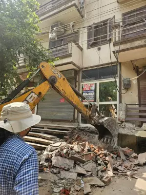
Addressing Encroachment Issues
During the inspection, civic authorities observed that illegal constructions both outside the historic ramparts and within the riverbed itself were significantly narrowing the river's natural course. This constriction has been identified as a primary reason why floodwaters frequently enter residential areas during monsoon seasons.
Taking a firm stance against these violations, Commissioner Sreekanth ordered the anti-encroachment department to immediately demolish all such illegal structures. The commissioner also directed authorities to prevent direct sewage release into the river, addressing both flooding and pollution concerns simultaneously.
Operational Strategy for Implementation
To ensure efficient execution of these directives, the necessary work will be carried out by deploying two separate teams:
- One team covering the stretch from Garam Pani to Barapulla Gate
- Another team responsible for the section from Himayat Bagh to Barapulla Gate
Concern Over Historic Barapulla Gate
During the inspection, Commissioner Sreekanth expressed strong displeasure over the dilapidated condition of the historic Barapulla Gate. The commissioner pointed out that this historic structure, once renowned for its twelve arches (Barapulla), has effectively been reduced to merely ten arches due to persistent encroachments over time.
This comprehensive approach to river management in Chhatrapati Sambhajinagar represents a significant step toward sustainable urban development and flood prevention. By combining scientific demarcation with active encroachment removal and riverbed restoration, authorities aim to create a safer, more resilient urban environment for all residents.