Residents of Noida and the wider Delhi-National Capital Region (NCR) woke up to a severe chill on Thursday, experiencing the coldest morning of the season so far. The mercury plunged to a low of 5.6 degrees Celsius, marking a significant drop of four notches below the normal seasonal average.
Record-Breaking Chill Grips the Region
This temperature of 5.6°C is not just the lowest minimum of the current season but also represents the coldest December morning in the first week of the month for at least the past 15 years, according to data records since 2011. The previous record for this period was set just a day earlier, on December 1, when the city recorded 5.7°C. Despite the intense cold, the India Meteorological Department (IMD) did not declare a cold wave for Thursday.
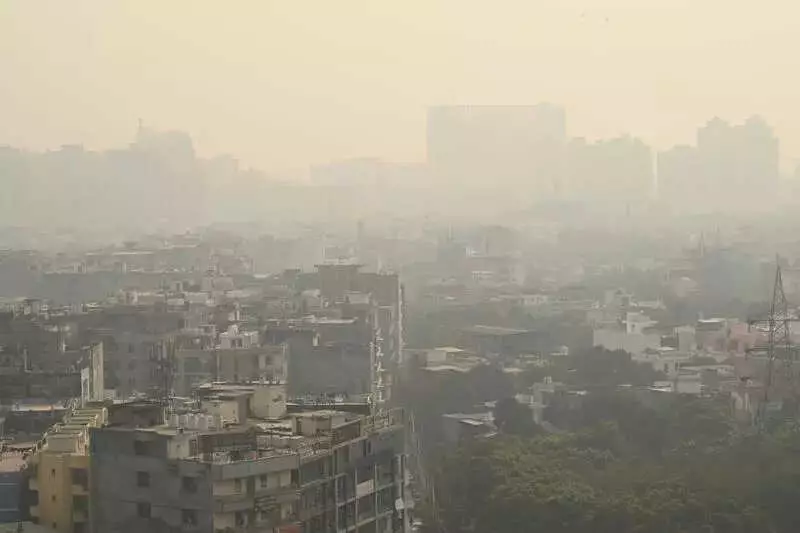
Marginal Improvement in Air Quality
In a slight positive development, the region's notorious air pollution showed signs of marginal improvement. The Air Quality Index (AQI) levels dipped into the lower range of the 'very poor' category across key NCR cities.

In Noida, the AQI improved to 308 on Thursday from 365 recorded on Wednesday. Neighbouring Ghaziabad also saw better numbers, with its AQI standing at 302 compared to the previous day's 324. The most notable improvement was observed in Greater Noida, where the AQI dropped to the 'poor' category, registering 285 against Wednesday's 324.
The national capital, Delhi, followed a similar trend. Its AQI improved but remained firmly in the 'very poor' range at 304, down from 342 a day earlier.
Weather Outlook and Wind Patterns
The IMD has forecast the possibility of a cold wave affecting isolated parts of the city on Friday. This prediction is attributed to the impact of chilly northwesterly winds sweeping across the plains.
Data from the Indian Institute of Tropical Meteorology (IITM) provides insight into the wind patterns that influenced Thursday's conditions. Surface winds throughout the day originated from the northwest, with speeds reaching up to 15 kmph during the afternoon. These winds slowed down to approximately 10 kmph by evening.
The forecast for Friday indicates that surface winds will continue to blow from the northwest. Wind speeds are expected to be around 10 kmph in the morning, increasing to about 12 kmph in the afternoon, before decreasing again to below 10 kmph during the evening and night hours. This pattern of cold winds is likely to keep the temperatures low and may further influence air quality dispersion.
While station-wise AQI data was reportedly unavailable on the Central Pollution Control Board (CPCB) portal, the overall trend suggests a cautious respite from the extreme pollution levels, even as the region braces for colder days ahead.