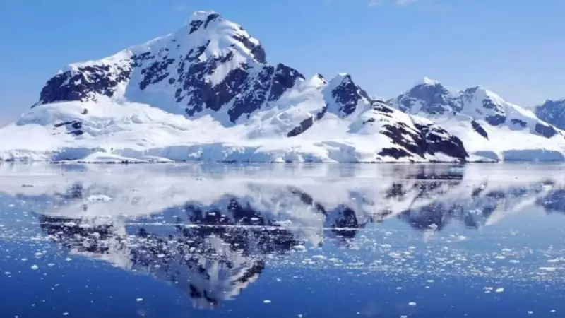
Antarctica's Hidden World Revealed: Mountains and Canyons Beneath the Ice
For most people, Antarctica represents a frozen, white desert—mysterious, remote, and unimaginably cold. However, a revolutionary new scientific map, published in Science in January 2026, is now uncovering a dramatic secret: beneath that immense ice sheet lies a rugged landscape of mountains, deep canyons, and hidden hills that resembles a secret version of Earth rather than the barren plain many once envisioned.
Unveiling the Subglacial Terrain
This stunning discovery stems from the major study titled "Complex mesoscale landscapes beneath Antarctica mapped from space," led by Helen Ockenden and colleagues. Using advanced satellite data and ice-flow physics, researchers have effectively decoded the bedrock hidden under two kilometers of ice for the first time.
Until now, scientists knew surprisingly little about what lies beneath the Antarctic ice sheet, despite it covering about 98% of the continent's surface. In fact, researchers previously had more knowledge about the surface of Mars than the bedrock underneath Antarctica's frozen blanket.

The Innovative Method: Ice Flow Perturbation Analysis
Through a novel technique called Ice Flow Perturbation Analysis (IFPA), scientists combined high-resolution satellite images with ice thickness measurements to estimate how ice moves and bends over the land below. This approach allowed them to decode the hidden landscape, revealing a far more complex world than anticipated.
The results are truly awe-inspiring. The team identified nearly 72,000 hills, more than double the number shown on previous maps, along with vast valleys and steep mountain peaks concealed under kilometers of solid ice. One remarkable feature is a canyon nearly 400 kilometers long, reminiscent of rugged alpine terrain rather than a frozen polar desert.
Why This Discovery Matters
You might wonder why this hidden landscape should matter to anyone beyond academic circles. The answer is surprisingly personal and has significant implications for our planet's future.
Antarctica's ice serves as one of Earth's most critical climate regulators. It holds a massive reservoir of freshwater, and its gleaming surface reflects sunlight back into space, helping to keep our planet cool. To predict how fast this ice might melt and what that means for rising sea levels, coastal cities, and extreme weather events, scientists must understand not just the ice itself but also what lies beneath it.
A rugged subglacial terrain creates friction, which can slow or speed up ice flow in different areas. This affects how the ice sheet responds to warming temperatures and ocean currents, directly influencing sea-level rise predictions. In essence, this discovery is not merely an obscure Antarctic detail; it is a crucial piece of the climate puzzle that could help us anticipate the future of our coastal cities.
Technological Breakthroughs
The innovation behind this discovery is nearly as remarkable as the landscape it revealed. By using satellite sensors to monitor tiny movements in the ice surface and combining them with thickness measurements from field surveys, scientists turned the ice sheet into a giant "X-ray" of the hidden terrain.
As one researcher explained, the ice acts like a recording tape—when it bends and flows over undiscovered bumps and ridges, those patterns reveal the shape below. With advanced physics models and modern computing power, researchers finally had the tools to decode this natural record.
A New Understanding of Antarctica
Before this study, portions of Antarctica's bedrock were so poorly mapped that scientists sometimes knew more about Mars than the land under Antarctica's ice. Now, thanks to IFPA and global satellite datasets, that is changing rapidly.
The new map uncovers geological features hidden for eons, which may hold clues about Earth's past climates, continental shifts, and how current ice dynamics will evolve in a warming world. As co-author Professor Mathieu Morlighem noted, understanding this landscape is "really important for ice-sheet models," especially as governments and climate scientists seek more accurate forecasts of ice melt and sea-level change.

Implications for Climate Science and Beyond
The hidden world beneath Antarctica's ice might never become a travel destination, but it is now an integral part of our global story. The rock beneath holds clues not only about Earth's geological past, carved over millions of years, but also about its climate future.
While tourists flock to glaciers in Iceland or fjords in Norway, this newly discovered Antarctic terrain reminds us that our planet's most dramatic landscapes are often hidden, waiting to be uncovered. As scientists refine their maps and develop sharper tools, we can expect even more revelations from beneath the ice.
What was once thought to be a monotonous ice sheet is now revealed as a continent with deep valleys, jagged hills, and geological complexity rivaling temperate landscapes. The knowledge gained from this discovery has profound implications for climate science, Earth history, and our understanding of one of the planet's final frontiers.
The revelations from the Science study serve as a powerful reminder that Earth still holds secrets, even under kilometers of ice, and that modern technology can help us uncover them with far-reaching consequences for our future.