After a spell of warmer and drier weather in parts of the country, much of the UK now faces a cooler and more unsettled week as bands of rain, sunshine, and showers move across the nation. The Met Office has indicated that Monday will begin with a wet and breezy start for many areas, particularly across England and Wales, before conditions gradually improve from the west. However, this improvement is unlikely to last long, as showers are expected to spread widely across the UK in the coming days.
Monday's Weather Outlook
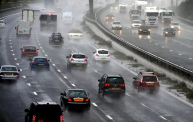
Forecasters stated that rain would continue pushing southeastwards throughout the day, gradually clearing later in the afternoon and evening. Northern Ireland and Scotland started the day with a mix of sunshine and frequent showers, and this showery pattern is expected to extend into many other parts of the UK by the end of the day. The Met Office noted that temperatures will remain below what many people would normally expect for early June, with brisk winds adding to the cool feel in several regions. Commuters in parts of southern England may experience difficult travel conditions during periods of heavier rain, while outdoor events could face interruptions as showers move through.
Evening and Night Conditions
Conditions are expected to become drier for a time across much of England and Wales during Monday evening as the main rain band finally clears. However, forecasters warn that showers will continue affecting Northern Ireland and Scotland before spreading south overnight into other parts of the country. Where skies remain clear for longer periods, temperatures could fall noticeably, bringing a rather chilly night by June standards. Rural areas and sheltered locations are likely to experience the coolest conditions before dawn.

Tuesday's Forecast
Tuesday is expected to bring a classic early-summer mix of sunshine and showers across the UK. Many areas will enjoy bright spells during the day, but showers are forecast to develop widely, particularly across northern England, Scotland, and Northern Ireland. The Met Office says some of these showers could become heavy and thundery, producing short bursts of intense rainfall and gusty winds. Despite the sunshine, temperatures are expected to remain on the cool side for this time of year, with many locations struggling to recover the warmth seen in recent weeks.
Midweek and Beyond
The broader outlook suggests little change through the middle and latter part of the week. Wednesday is expected to bring further sunshine and showers across many regions. Another area of rain is forecast to move eastwards across the country on Thursday before clearing and allowing a return to sunshine and scattered showers on Friday. While most parts of the UK will remain cooler than average, the far southeast of England could begin to see slightly warmer conditions by the end of the week. The overall message from the Met Office is that the UK will remain in a changeable weather pattern, with no prolonged spell of settled summer weather currently in sight.
Travel and Activity Advice
For those planning travel, outdoor activities, or sporting events, it will be worth keeping an umbrella close at hand and checking local forecasts regularly as conditions continue to change from day to day. The Met Office advises staying updated with the latest information to navigate the unsettled conditions effectively.
About the Author: TOI World Desk - At TOI World Desk, our dedicated team of seasoned journalists and passionate writers tirelessly sifts through the vast tapestry of global events to bring you the latest news and diverse perspectives round the clock. With an unwavering commitment to accuracy, depth, and timeliness, we strive to keep you informed about the ever-evolving world, delivering a nuanced understanding of international affairs to our readers. Join us on a journey across continents as we unravel the stories that shape our interconnected world.