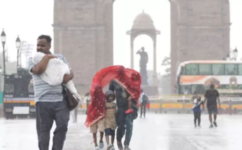
On Tuesday afternoon, rain lashed several parts of the national capital, bringing significant temperature drops across the city. The India Meteorological Department (IMD) has forecast that thunderstorm and rain activity will continue through the evening hours.
Red Alert and Strong Winds
Amid a red alert issued by IMD for most parts of Delhi, strong winds and dust storms swept through the city, providing respite from the rising heat. According to IMD data, Safdarjung, the city's representative weather station, recorded a wind speed of 52 kmph at 2:30 pm. Other stations recorded even higher speeds, with Palam reaching 91 kmph at the same time. Pusa recorded 85 kmph at 3 pm, and Chattarpur recorded 43 kmph at 3:15 pm.
An IMD official stated, "The maximum wind speed was recorded at Palam, which reached up to 49 knots or approximately 91 kmph. The wind direction was west to south-west." The official added that thunderstorms and light to moderate rain are expected to continue in the next few hours.

Temperature Drops Across the City
IMD data showed substantial temperature declines in several areas. Palam recorded a 10-degree Celsius fall after thunderstorm activities, while Safdarjung saw a seven-degree drop. The most significant decrease was at Ayanagar, where the temperature fell by 14.9 degrees, from 40.6°C to 25.7°C. Jafarpur recorded an 11.6-degree drop, Pusa a 7.6-degree drop, and Najafgarh an 8.2-degree drop.
Delhi had recorded a minimum temperature of 26.8 degrees Celsius on Tuesday morning, providing a baseline for the dramatic cooling effect of the storms.
Forecast and Impact
The IMD has indicated that more showers are likely in the coming hours, which should continue to keep temperatures lower and provide further relief from the heatwave conditions that had gripped the city. The red alert remains in place for most parts of Delhi, advising residents to take precautions against strong winds and lightning.