Drone Surveys Ordered for Crop Loss Assessment
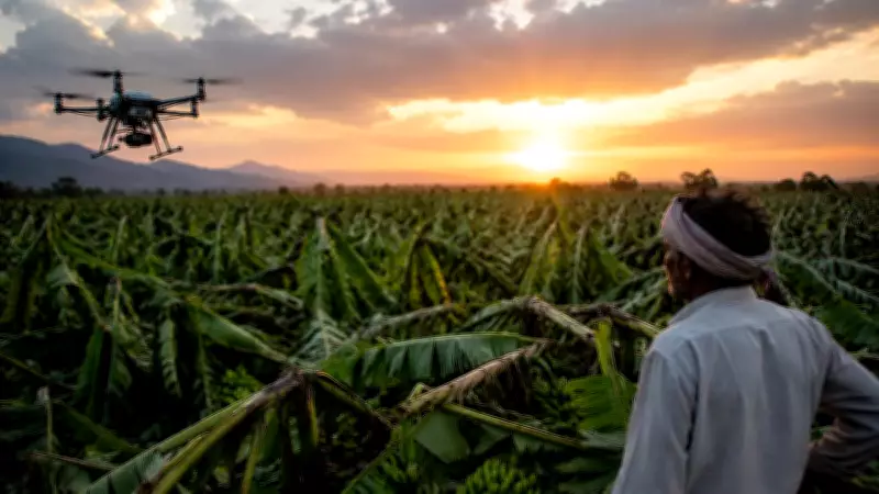
Maharashtra Chief Minister Devendra Fadnavis has directed officials to conduct drone surveys to assess crop losses in the state, particularly in the Jalgaon district where banana crops have been severely damaged. The decision was taken during a meeting chaired by Fadnavis at the Vidhan Bhavan complex in Mumbai on Tuesday.
The CM emphasized the need for accurate and timely assessment of crop damage to ensure that farmers receive compensation without delay. He instructed the agriculture department to deploy drone technology for surveying affected areas, which will provide precise data on the extent of the loss.
Focus on Banana Crop Damage in Jalgaon
Jalgaon, known as a major banana-producing region, has witnessed significant crop loss due to adverse weather conditions. Farmers have been struggling with damaged plantations, and the state government aims to expedite the relief process. Fadnavis specifically reviewed the banana crop damage and sought a detailed report from district authorities.

The CM also directed insurance companies to process claims quickly and ensure that farmers get their payouts at the earliest. He stressed that delays in compensation should be avoided, and the entire process must be streamlined.
Instructions to Insurance Companies
Fadnavis instructed insurance firms to expedite the settlement of claims for affected farmers. He said that the government would monitor the process closely to ensure compliance. The meeting was attended by senior officials from the agriculture department, district administration, and representatives of insurance companies.
According to a government statement, the CM has asked for a weekly progress report on the insurance claims and drone survey results. He also directed that farmers be informed about the survey schedule and the claim process through local channels.
Technology-Driven Approach for Accuracy
The use of drones for crop loss assessment is part of the state's push towards technology-driven governance. Officials believe that drone surveys will provide more accurate and faster assessments compared to traditional ground surveys. This will help in reducing disputes and ensuring fair compensation.
The CM's directive comes amid concerns over delayed insurance payouts in the past. By leveraging technology and strict monitoring, the state aims to address the grievances of farmers and provide timely relief.