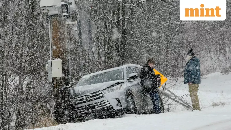
A fierce winter storm, known as a 'bomb cyclone,' has unleashed chaos across the United States' Upper Midwest, leaving hundreds of thousands without electricity and severely disrupting travel at the start of the week. The powerful weather system, characterised by rapidly intensifying winds and heavy snowfall, has created conditions reminiscent of a 'winter hurricane.'
Widespread Power Outages and Travel Chaos
As per reports, a staggering 350,000 customers suffered from power outages on Monday morning. The state of Michigan bore the brunt of the storm, accounting for approximately one-third of all affected customers. The USA Today Power Outage Tracker indicated that over 100,000 customers in Michigan alone were left in the dark. The travel sector faced parallel disruptions, with the flight-tracking website FlightAware reporting more than 1,600 flight delays and over 450 cancellations across US airports on Monday.
Ground Zero: Michigan's County-by-County Breakdown
The impact within Michigan was severe and widespread. Clare County, still recovering from an ice storm on Friday and Saturday, was the worst affected, with 15,004 customers (over 56% of the total) without power. A blizzard warning remained active in the Upper Peninsula, where Marquette County witnessed 12,054 outages. Other counties grappling with significant power cuts included Gladwin (3,006), Osceola (4,579), Isabella (5,826), Mecosta (7,040), and Oakland (5,053). Among utility providers, Consumers Energy reported the highest number of affected customers at 51,442, followed by DTE Energy (13,308) and Great Lakes Energy (12,569).

What is a Bomb Cyclone?
The term 'bomb cyclone' describes a storm that undergoes rapid intensification. According to the National Oceanic and Atmospheric Administration (NOAA), this occurs when a mass of cold, dry air collides with a body of warm, moist air, causing a dramatic drop in atmospheric pressure. The current storm, moving eastwards, is expected to intensify further due to a clash between frigid air from Canada and lingering warm air in the southern US.
Meteorologists have warned of continuing hazards. The National Weather Service in Grand Rapids noted that snow moved from west to east between 12-4 am on Monday, with west winds expected to blow at 45 to 55 mph during Monday afternoon. Bil Deger, a Senior Meteorologist at AccuWeather, cautioned that such strong winds could lead to prolonged power outages, downed tree limbs, and even turn holiday decorations into dangerous projectiles. Authorities have warned residents to prepare for hazardous travel conditions and further power cuts.
In response to the crisis, Minnesota Governor Tim Walz authorised the National Guard via a post on X (formerly Twitter) to support emergency winter storm operations aimed at alleviating dangerous road conditions. This action comes as blizzard warnings remain in effect for Michigan, North Dakota, Minnesota, and Wisconsin, underscoring the severe and ongoing nature of this winter weather event.