New York City is preparing for another significant winter weather event as a bomb cyclone storm system approaches the region. Forecasters are warning residents to brace for potentially hazardous conditions over the weekend, with snowfall accumulations and frigid temperatures expected to create challenging circumstances.
Storm Timeline and Snowfall Predictions
According to meteorological reports from AccuWeather and the New York Post, the bomb cyclone is projected to arrive in the New York metropolitan area on Saturday night and persist through Sunday. Current forecasts indicate that New York City could receive upwards of 3 inches of fresh snow accumulation, adding to the existing snowpack from recent winter storms.
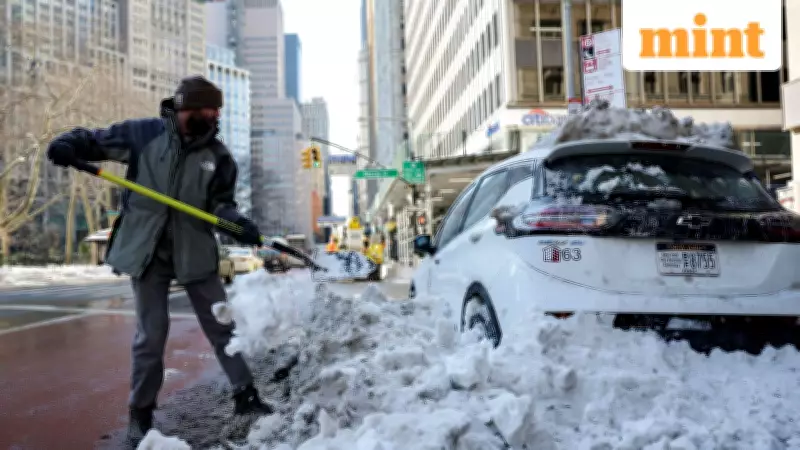
This comes as the region continues to recover from Winter Storm Fern, which brought substantial snowfall just days earlier. The timing of this new storm system presents additional challenges for cleanup efforts and transportation networks.

Dangerous Wind Chill and Temperature Concerns
Beyond the snowfall, meteorologists are particularly concerned about accompanying wind conditions and plummeting temperatures. AccuWeather experts have warned that strong winds will likely accompany the bomb cyclone, creating dangerous wind chill factors throughout the affected areas.
"Regardless of the storm track, it will likely be a blustery day on Sunday, especially from the city on the east and south," explained AccuWeather senior meteorologist Matt Benz in an interview with The New York Post.
Temperatures that have been hovering between approximately 14 and 24 degrees Fahrenheit could potentially drop into single digits, with some areas possibly experiencing below-zero readings. These conditions create exceptional danger for exposed skin and increase risks for vulnerable populations.
Comparison to Previous Winter Storm
While the approaching storm system warrants serious attention, meteorologists suggest it may not reach the severity of Winter Storm Fern that impacted the northeast region last weekend. "Unless there is a major shift in the storm track to the west, we don't expect travel conditions to be as dangerous as they were compared to last weekend here in the City," Benz clarified.
However, he noted that conditions could be significantly worse in areas east of New York City, particularly on Long Island where snowfall accumulations might reach up to 6 inches. White-out blizzard conditions could potentially overtake both northern and southern sections of Long Island, creating extremely hazardous travel conditions.
Extended Cold Spell and Snow Persistence
Even after the storm passes, expected to blow out by Sunday night, the aftermath will linger. Meteorologists have cautioned that the snow is likely to remain for days due to persistently frigid temperatures well below freezing levels that prevent melting.
In New York City specifically, these sub-freezing temperatures aren't expected to break until February, creating an extended period of cold weather. Forecasters have described the coming cold spell as "exceptionally dangerous" with temperatures expected to remain in the teens and 20s for an extended duration.
Understanding Bomb Cyclone Weather Patterns
The term "bomb cyclone" or bombogenesis refers to a specific meteorological phenomenon characterized by rapidly intensifying winter storms that typically form over ocean waters. These weather systems develop deadly power quickly, often catching regions unprepared for their severity.
These storms earn their dramatic name from their explosive development, with central pressure dropping at least 24 millibars within 24 hours. This rapid intensification creates powerful winds and significant precipitation that can impact large geographic areas.
Regional Impact Beyond New York City
The bomb cyclone's effects will extend well beyond New York City, impacting much of the East Coast from South Carolina through Maine. According to AccuWeather forecasts, various regions will experience different snowfall accumulations:

- Boston could see between 3 and 6 inches of snow
- Philadelphia and Washington, DC might receive between 1 and 3 inches
- Central regions of Virginia and North Carolina could experience between 6 and 12 inches
This widespread impact comes as many areas are still recovering from Winter Storm Fern, which dumped significant snow across the region earlier in the week. The consecutive nature of these winter storms presents particular challenges for emergency services, transportation departments, and residents throughout the affected states.
As the bomb cyclone approaches, authorities are urging residents to take necessary precautions, limit unnecessary travel, and prepare for potentially extended periods of cold weather following the storm's passage.