Satellite Imagery Confirms Widespread Destruction in Iran's Isfahan Province
Recent satellite images have unveiled extensive damage at multiple military and strategic sites in Iran's Isfahan province, following coordinated strikes by the United States and Israel. The photographs, released by AP, provide a stark visual account of the impact on key infrastructure in this central Iranian region.
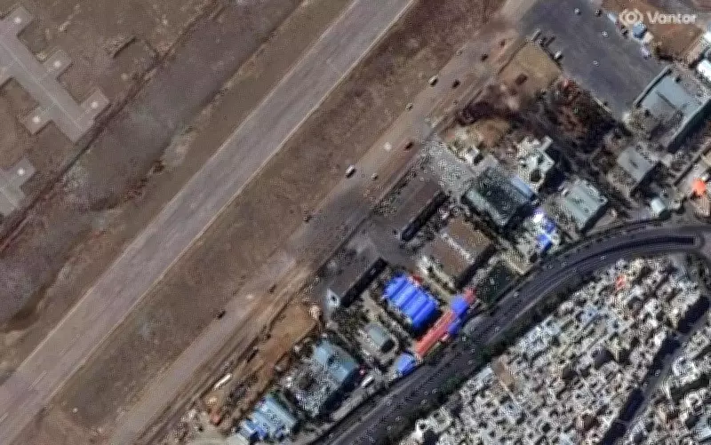
Detailed Damage Assessment at Key Locations
The satellite images capture visible destruction at several critical facilities. At Isfahan International Airport, the imagery shows destroyed buildings and sections of the tarmac, with thick black smoke visible in some frames, indicating recent strikes. A wider overview of the airport complex and surrounding areas reveals further structural compromises.
Additionally, the images highlight significant damage at a missile complex in the Isfahan region. This includes destroyed tunnel entrances that are believed to be part of underground facilities, suggesting targeted efforts to disrupt Iran's military capabilities. Separate satellite views also depict structural damage to buildings at a nearby military garrison, underscoring the breadth of the airstrikes.

Impact on Strategic and Industrial Hub
Isfahan province is a key industrial and military hub for Iran, and the collective imagery indicates that multiple sites in and around the city were impacted. Among the locations identified are buildings linked to the Natanz nuclear facility, situated in Isfahan province and long associated with Iran's nuclear program. The satellite photographs provide a comprehensive overview of the extent of damage across affected sites, including airport infrastructure, military installations, and suspected missile facilities.
The release of these images comes amid escalating tensions in the region, following reported US and Israeli strikes targeting Iranian military and strategic infrastructure. This visual evidence adds a new dimension to the ongoing conflict, highlighting the tangible effects of the airstrikes on Iran's defensive and offensive assets.
Context of Regional Tensions
The damage assessment follows a series of retaliatory actions, including Iran firing a first wave of missiles at Israel under new Supreme Leader Mojtaba Khamenei. Videos have emerged challenging previous claims, such as one appearing to show a US Tomahawk missile hitting an IRGC facility near a school in Iran, where over 160 casualties were reported. Another video shows thick black smoke rising after Iran targeted Bahrain's largest BAPCO oil refinery, further complicating the regional dynamics.
These developments underscore the volatile situation in the Middle East, with satellite imagery serving as a crucial tool for verifying the scale and specifics of military engagements. As tensions continue, the global community closely monitors these events, with the images providing undeniable proof of the strikes' impact on Iran's strategic landscape.