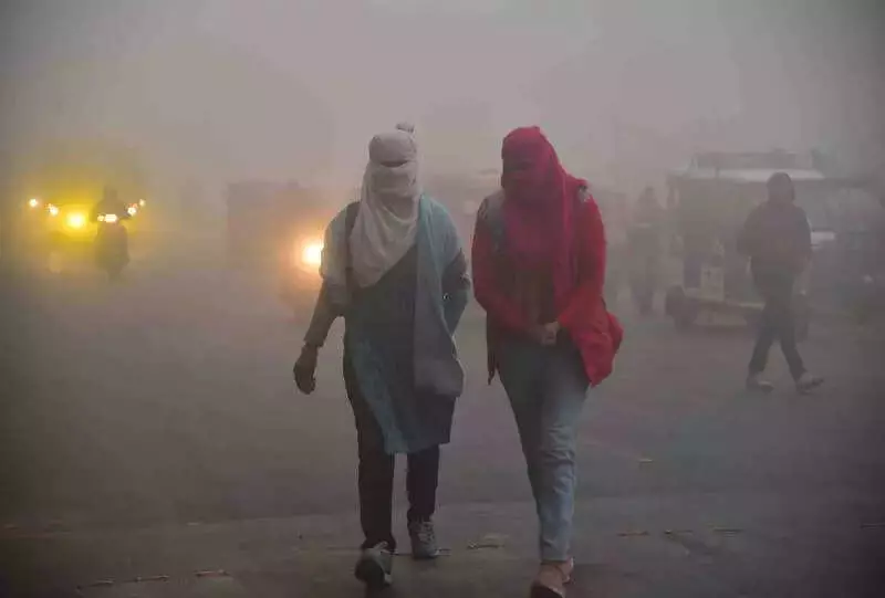
Uttar Pradesh remained in the icy grip of severe 'cold day' conditions on Saturday, with dense fog severely limiting visibility and keeping daytime temperatures unusually low. The state capital, Lucknow, along with other major cities, witnessed disrupted life as the meteorological department indicated these harsh conditions would persist for the next 48 hours.
Mercury Plummets, Visibility Drops
Lucknow recorded a maximum temperature of just 16 degrees Celsius, a marginal increase of 0.5°C from previous days, while the minimum settled at 9.8°C. The real challenge, however, was the thick blanket of fog that reduced visibility to between 50 and 500 meters. This led to significant disruptions in vehicular movement during the crucial morning and evening hours on key routes across the capital.
The situation was even more severe in other parts of the state. Bareilly registered the state's lowest maximum temperature at 13.2°C, followed closely by Shahjahanpur at 13.9°C and Ayodhya at 14°C. The persistent fog layer and the conspicuous absence of sunshine were the primary culprits behind these punishing 'cold day' phenomena, where daytime highs remain dangerously close to nighttime lows.

The Science Behind the Chill
Meteorologists have pinpointed two key atmospheric players causing this extended cold spell. An inversion layer in the lower troposphere and an anti-cyclone over central India are effectively trapping cold, dense air near the surface, preventing the normal daytime warming. Furthermore, a tropical westerly jet stream influencing north India's weather is reinforcing this surface stability and maintaining the low temperatures.
Senior Scientist at IMD, Mohammad Danish, explained, "The present conditions are a result of a system over the Arabian Sea and a Western Disturbance that brought moist westerly winds into the region." He confirmed that the cold weather would hold sway for the next two days before any noticeable change.
Hope for Temporary Relief
There is, however, a silver lining on the horizon. The India Meteorological Department (IMD) has forecast that a Western Disturbance approaching from the northwest is likely to affect the region within the next 24 hours. This system is expected to weaken the stubborn inversion layer, reduce the intensity of the fog, and lead to an increase in both maximum and minimum temperatures by about 2-3°C.
This period of improvement is predicted to last for two to three days after December 21. The IMD has issued color-coded alerts for various districts, with orange and red alerts in place due to the hazardous low visibility and extreme cold. Officials have strongly advised residents to avoid non-essential travel during early morning and late-night hours and to take necessary precautions against prolonged exposure to the cold.
Following this brief respite, temperatures are likely to dip again as fog density is expected to increase from December 24. Danish added that temperatures could decline once fresh cold winds set in, before gradually rising later in the week. Residents are urged to stay updated with the latest weather bulletins and plan their activities accordingly.