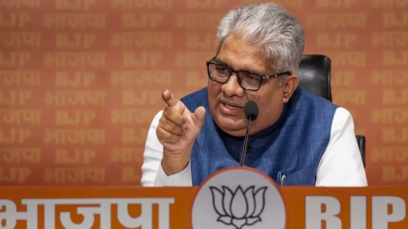
Union Environment Minister Bhupender Yadav has provided crucial clarifications regarding mining activities in the ecologically sensitive Aravalli range, stating that extraction will be permitted in only a minuscule fraction of the total area. This announcement comes amidst significant public concern and protests triggered by a recent redefinition of what constitutes the Aravalli hills.
Strict Limits and a Mandatory Study
Addressing the media on Monday, December 23, 2025, Minister Yadav emphasized that mining would be restricted to a mere 0.19% of the Aravalli landscape. In concrete terms, this translates to 277.89 square kilometers out of the vast total area of 1,43,577 sq km that spans 37 districts across three states.
He provided a detailed breakdown of this limited mining lease area: 247.21 sq km lies within 20 districts of Rajasthan, 27.35 sq km in Gujarat, and 3.33 sq km in Haryana. Crucially, the Minister underlined that no new mining leases will be sanctioned until a comprehensive, scientific study is completed.

Clarifying the New Aravalli Definition
The Minister's statements are a direct response to the controversy surrounding a new, uniform definition of the Aravalli hills and ranges, which was submitted to the Supreme Court by a technical expert committee. This definition classifies any landform at an elevation of 100 metres or more above the local relief as part of the Aravallis.
Yadav sought to explain that this definition is specifically for regulating the mining sector, as directed by the Supreme Court. He clarified that the 100-metre elevation is measured from the base of the mountain structure, and mining will not be permitted around or beneath this structure. "The court asked to form a technical committee only for the purpose of the mining sector, and this (new definition) is also restricted to the purpose of mining," he stated.
The Path Forward: A Sustainable Management Plan
The roadmap for any future sustainable mining activity is now clearly defined. Following Supreme Court orders, the Indian Council of Forestry Research and Education (ICFRE) will prepare a detailed Management Plan for Sustainable Mining (MPSM).
"They (ICFRE) will prepare a detailed district-by-district plan. It will be clarified which hill can be mined or not," Yadav explained. This plan will not only identify permissible mining areas but will also demarcate:
- Ecologically sensitive zones
- Conservation-critical areas
- Regions prioritized for restoration
The Minister noted that the Supreme Court's November 20 judgment accepted the expert committee's recommendations on core and inviolate areas. The only exception to the ban on new leases would be for critical, strategic, and atomic minerals.
Protecting a Vital Ecological Barrier
The context for these stringent measures is the critical role the Aravalli range plays in India's ecology. The hills act as a vital green barrier, preventing the spread of the Thar Desert and combating desertification in the fertile Indo-Gangetic plains, Haryana, and western Uttar Pradesh.
The Supreme Court itself acknowledged in its judgment that the mountain range faces escalating degradation pressures from activities like illegal mining. The court mandated that the sustainable management plan must consider the region's rich biodiversity, protected areas, aquifers, and wetlands before any mining permission is granted.
Minister Yadav's detailed clarification aims to balance environmental conservation with regulated resource use, ensuring the protection of one of North India's most crucial natural features while allowing for strictly controlled and studied mineral extraction in a tiny, designated portion.