After enduring a prolonged dry spell, Himachal Pradesh has been transformed by widespread rain and snowfall over the past 24 hours. This significant weather event has dramatically lowered temperatures across the state, disrupting normal life while simultaneously raising hopes for farmers, orchardists, and the tourism sector.
Detailed Meteorological Data and Impact
According to the India Meteorological Department (IMD), the Meteorological Centre in Shimla reported light to moderate rain and snowfall at most locations, with heavy precipitation recorded at several specific sites. IMD data reveals a marked decline in maximum temperatures, with readings remaining 5 to 12 degrees Celsius below normal levels. Minimum temperatures also experienced a notable dip.
Recorded Temperatures and Precipitation
The state's lowest minimum temperature was recorded at Kukumseri in Lahaul-Spiti, plunging to minus 7.2 degrees Celsius. In contrast, Bajaura in Kullu registered the highest maximum temperature at 18.2 degrees Celsius. Several regions reported very heavy rainfall, including Dharampur with 91.4 mm, Solan with 68.6 mm, and Kandaghat with 67 mm. Palampur, Una, Nahan, and Seobagh also witnessed over 50 mm of rainfall.

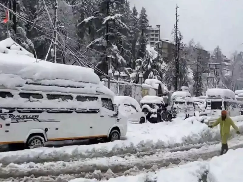
On the snowfall front, Kothi received 105 cm, Gondla 85 cm, Keylong 75 cm, Kufri 66 cm, Manali 45.8 cm, and Shimla recorded approximately 40 cm of snow. This extreme weather prompted IMD to declare severe cold day conditions in Shimla, Manali, Mandi, Bilaspur, and Hamirpur, while severe cold wave conditions prevailed in Kangra district. Gusty winds were also observed, with speeds reaching 81 kmph at Narkanda and 70 kmph in Shimla.
Weather Systems and Future Forecast
The IMD attributed this weather phenomenon to a western disturbance in the form of a low-pressure area over Jammu and adjoining Pakistan, supported by cyclonic circulation and a strong subtropical westerly jet stream. The department has issued a warning that a fresh western disturbance is likely to affect northwest India from January 26, potentially bringing another spell of rain and snow, particularly on January 27, when heavy precipitation is expected at isolated places over high hills.
Upcoming Weather Patterns
Looking ahead, IMD forecasts light to moderate rain and snowfall at many locations on January 27, followed by a gradual improvement in weather conditions. Minimum temperatures are expected to rise gradually by 2-3 degrees Celsius, while maximum temperatures may increase by 6-10 degrees Celsius in the coming days. Dry weather is likely to prevail over most parts of the state by January 29 and 30.
Advisories and Disruptions
Authorities have advised residents and tourists to exercise caution, especially in high-altitude and landslide-prone areas, as road blockages, slippery conditions, and reduced visibility are anticipated during periods of heavy snow and rain. So far, over 600 roads have been blocked across the state, highlighting the significant disruption to daily life and transportation networks.
This weather event, while challenging, brings crucial moisture to the region, benefiting agricultural activities and potentially boosting winter tourism in popular destinations like Shimla and Manali. The state continues to monitor the situation closely as it prepares for the anticipated additional precipitation in the coming days.