In a significant step for India's water resource management and disaster preparedness, the Visvesvaraya National Institute of Technology (VNIT) in Nagpur has successfully completed a sophisticated riverbed survey in Arunachal Pradesh. This work addresses the growing national priority for accurate data to manage dam safety, floods, and downstream risks.
Mapping the Hidden Riverbed: The Boasimla Survey
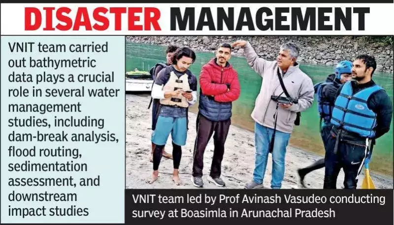
The institute undertook a professional consultancy assignment at Boasimla in Arunachal Pradesh, focusing on an advanced bathymetric survey and river cross-section analysis. Bathymetry involves measuring underwater riverbed levels and contours, while cross-section analysis studies the shape and depth of the river at specific points. This precise data is essential for informed decision-making during natural disasters.
For the fieldwork, experts used a floating survey platform fitted with specialised instruments to map the underwater riverbed in detail. The collected data was then processed using advanced software tools designed for hydraulic and spatial analysis. This method allows for the exact measurement of river geometry, which traditional land-based topographic surveys cannot capture.

Why Riverbed Data is Critical for Safety
The information gathered from such surveys plays a vital role in multiple water management studies. Key applications include:
- Dam-break analysis: Simulating potential flood scenarios if a dam were to fail.
- Flood routing: Predicting how flood waves would move downstream.
- Sedimentation assessment: Evaluating the build-up of silt and sand on the riverbed.
- Downstream impact studies: Analysing the effects of flooding on communities and infrastructure along the river.
Changes in the riverbed and sediment accumulation directly affect how fast a flood travels, how deep the water gets, and how much area is inundated. These factors are especially critical during extreme rainfall or emergency water releases from reservoirs.
Broader Implications for States Like Maharashtra
For states with major dams and regulated rivers flowing through densely populated areas, such as Maharashtra, having updated and reliable riverbed information is increasingly important. This data supports several crucial initiatives:
It aids in dam safety reviews, which are periodic technical evaluations of dam structures. It also strengthens emergency action plans for sudden flood situations. Furthermore, accurate data feeds into hydraulic models—mathematical simulations of river flow—giving water resource departments greater confidence in operational decisions and public safety planning.
The consultancy was led by Prof Avinash Vasudeo from VNIT Nagpur's civil engineering department, who brings over 25 years of experience at the institute. His expertise spans hydrology, river engineering, and ground investigation techniques.
This project underscores how advanced technical research and fieldwork are fundamental to building resilience against water-related disasters across India.