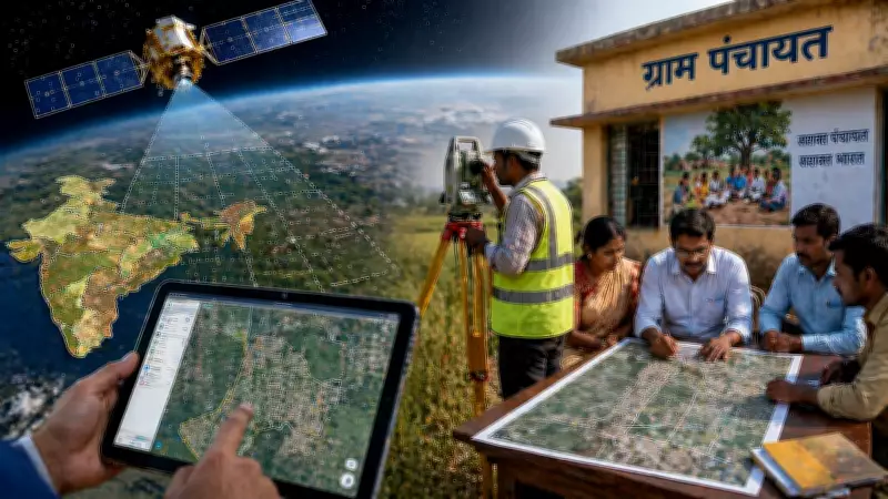
The Indian Space Research Organisation (ISRO) has collaborated with the Panchayati Raj Ministry to successfully complete a comprehensive land mapping project across the nation. This initiative aims to bolster rural planning and governance by providing accurate and up-to-date land records.
Scope of the Project
The project involved mapping land parcels in over 2.5 lakh villages, utilizing high-resolution satellite imagery and geospatial technology. The data collected will be integrated into the Digital India Land Records Modernization Programme (DILRMP), ensuring transparency and efficiency in land administration.
Benefits for Rural Development
This mapping endeavor is expected to significantly improve the implementation of various government schemes, including the Pradhan Mantri Awas Yojana and the Mahatma Gandhi National Rural Employment Guarantee Act. It will aid in better resource allocation, dispute resolution, and infrastructure planning at the grassroots level.

Technological Collaboration
ISRO's expertise in satellite-based remote sensing and the Panchayati Raj Ministry's on-ground network facilitated the seamless execution of this massive task. The use of Bhuvan, ISRO's geospatial platform, enabled real-time data sharing and analysis.
Future Implications
The completion of this project marks a significant milestone in India's journey towards digital governance. It lays the foundation for a more robust and transparent land management system, empowering local bodies with precise data for informed decision-making.