Researchers at the Indian Institute of Technology (IIT) Kharagpur have introduced a scientific framework that merges urban heat and air pollution exposure into a unified health-risk indicator. This innovative tool is designed to support sustainable urban planning and the development of climate-resilient cities.
Study Focuses on Delhi as a Test Case
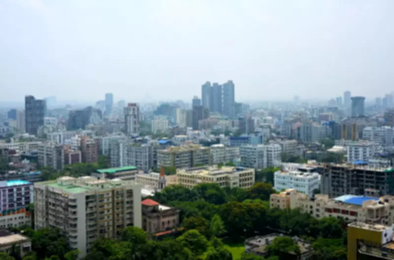
The study, which used Delhi as a test case because it is the most polluted metropolitan area in the country, resulted in the creation of the Urban Heat and Pollution Index (UHPI). This index jointly evaluates the combined effects of Urban Heat Island (UHI) intensity and multiple air pollutants, illustrating how these stressors interact and amplify risks for urban populations.
Research Leadership and Publication
Led by Jayanarayanan Kuttippurath and VK Patel at the Centre for Ocean, River, Atmosphere and Land Science (CORAL) at IIT Kharagpur, the research was published in Case Studies in Chemical and Environmental Engineering. The study addresses a key limitation in conventional urban assessments, where heat and air pollution are typically analyzed separately.

“The study argues that this separation can underestimate real-world exposure because rapid urbanization, rising anthropogenic emissions, and warming climate conditions increasingly produce simultaneous heat-pollution stress,” explained Kuttippurath.
Spatial Differences in Combined Risk
Applying the UHPI to Delhi, the researchers identified clear spatial differences in combined risk. Central and eastern areas, along with parts of northwestern Delhi—including densely built and industrial zones—exhibited higher UHPI values, indicating greater environmental stress and increased public health vulnerability. In contrast, greener and less densely developed peripheral areas showed lower UHPI values, suggesting comparatively lower combined exposure and potential advantages for more sustainable urban expansion.
Future Plans for Other Cities
Kuttippurath stated that a similar risk map is being prepared for Kolkata and is expected to be ready by the end of the year or early next year. “The initial data indicates that a place like New Town is less environmentally stressed than suburban areas within the Kolkata Metropolitan Area with high population concentration and low green cover,” he said.
The team plans to create risk maps for other major cities, including Mumbai, Chennai, Hyderabad, Bengaluru, Pune, and Ahmedabad. These maps will outline integrated policy actions aligned with UHPI findings, such as expanding green infrastructure, improving sustainable transport, reducing vehicular and industrial emissions, preserving open spaces, strengthening urban ventilation corridors, and adopting climate-sensitive planning.
“Interventions targeting only temperature or only pollution can miss cumulative exposure and lead to underestimation of health risk,” the IIT professor added.
UHPI as a Scalable Decision-Support Tool
The researchers position the UHPI as a scalable decision-support tool for urban planners, public health agencies, and policymakers. It has potential applications in both developing and developed cities to guide climate-resilient and health-focused urban development.
What is UHPI?
The Urban Heat Pollution Index (UHPI) jointly assesses the combined impacts of multiple air pollutants and urban heat island effects on human health and urban sustainability.

Why This Matters
- Evidence-based urban planning: Helps city planners identify high-risk zones and prioritize low-risk, green, and well-ventilated areas for development.
- Public health protection: Supports health risk assessment and better preparedness against compounded heat and pollution exposure.
- Strong policy support: Empowers policymakers, public health authorities, and environmental agencies with a powerful decision-support tool.
- Globally applicable: The UHPI framework is scalable and adaptable for cities across developing and developed nations worldwide.