Attingal Municipality Embraces Student-Created Land Suitability Atlas for Strategic Infrastructure Development
In a pioneering move, the Attingal municipality in Thiruvananthapuram district has officially decided to adopt a comprehensive ward-level land suitability atlas meticulously prepared by students from the Government Model Boys Vocational Higher Secondary School in Attingal. This innovative atlas is set to become a crucial tool for guiding the siting of waste management facilities and various infrastructure projects, which have historically faced significant public resistance and opposition from local residents.
Scientific Data to Guide Municipal Planning and Reduce Public Opposition
Municipality chairperson M Pradeep announced that the civic body will rely extensively on the atlas and its accompanying dataset while planning and executing upcoming projects, particularly those that tend to encounter resistance from the community. Pradeep emphasized that several critical waste management and public infrastructure initiatives are currently in the pipeline, and having access to scientifically backed, hyperlocal data will empower the municipality to clearly explain and justify the rationale behind selecting specific locations for these developments.
"Access to ward-level scientific data will help authorities justify project-siting decisions and significantly improve public acceptance, especially in environmentally sensitive areas," Pradeep stated. He added that the atlas will serve as an essential reference document for all future infrastructure planning and disaster mitigation efforts within the municipality, ensuring decisions are grounded in empirical evidence.

Addressing Climate Challenges Through Hyperlocal Geography
Suresh Kumar S, the Geography teacher at the school who spearheaded the project, highlighted the increasing incidence of erratic rainfall and severe waterlogging across Kerala as a primary motivation. He explained that these climate-related challenges underscore the urgent need for hyperlocal, data-driven planning approaches that consider the unique geographical characteristics of each area.
"The project aimed to help students understand their local landscape in depth and apply their geographical findings in a socially relevant and practical manner," Suresh Kumar noted. The initiative was designed to translate theoretical classroom learning into actionable, community-oriented knowledge by examining both physical and human geography factors at the municipal level.
Comprehensive Mapping of Terrain and Environmental Vulnerabilities
The detailed atlas meticulously maps a wide range of critical terrain features, soil conditions, elevation patterns, and flood vulnerability assessments across all 31 municipal wards. It specifically identifies and flags low-lying areas, flood-prone zones, and drainage-sensitive regions that are unsuitable for construction, while simultaneously highlighting comparatively safer locations that are more suitable for sustainable development.
Key findings from the atlas include the identification of valley-fill zones and naturally low-lying areas where construction activities could severely disrupt natural drainage systems, potentially exacerbating flooding issues. Conversely, the study pinpoints areas with stable soil and favorable elevation that are better suited for infrastructure projects, providing a balanced view for planners.
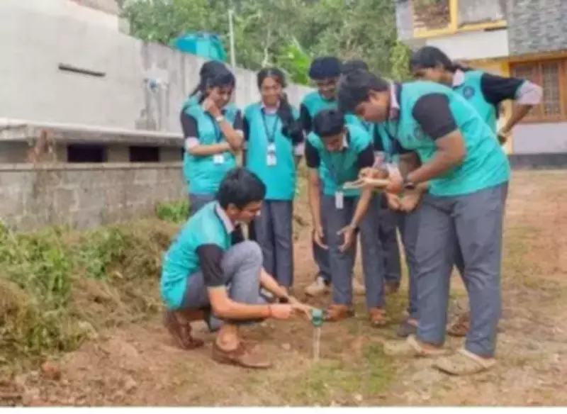
Student-Led Initiative Combining Fieldwork and Advanced Technology
This remarkable atlas was prepared as an integral part of an academic geography master plan, receiving support from Samagra Shiksha and technical guidance from climate experts. The student-led initiative employed a multidisciplinary approach, combining rigorous field surveys, detailed soil analysis, high-resolution satellite imagery, and advanced GIS-based mapping techniques to generate highly detailed, ground-level data.
The project exemplifies how educational initiatives can directly contribute to community development and informed governance. The atlas is scheduled to be formally inaugurated by General Education Minister V Sivankutty in the coming days, marking official recognition of the students' valuable contribution to municipal planning and environmental stewardship.