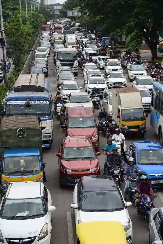
Commuters in Bengaluru, long plagued by relentless traffic snarls, can finally glimpse a future of smoother journeys. The city is gearing up for a massive infrastructure push with plans to construct five elevated corridors spanning nearly 80 kilometres to decongest its busiest arterial roads.
B-Smile Fast-Tracks Project with Consultant Bids
In a significant move to accelerate these crucial projects, Bengaluru Smart Infrastructure Ltd (B-Smile) has officially invited bids for consultancy services. The agency issued a request for proposal (RFP) on Friday, calling for experienced project management consultants (PMCs), detailed project report (DPR) consultants, and proof-checking agencies. The bidding process will follow a two-cover system, with submissions accepted exclusively via the Karnataka government's official procurement portal.
The core objective of these proposed elevated corridors is to divert through-traffic away from the heavily congested surface roads, providing much-needed relief on key commuter routes that connect the city's eastern, western, northern, and southern sectors.

Detailed Breakdown of the Five Proposed Corridors
The ambitious plan encompasses several critical stretches known for daily gridlock. One major project is a 17.9-kilometre, six-lane (3+3) elevated corridor from Nagavara Junction to Bagalur Main Road. This route will pass through RK Hegde Nagar, Sampigehalli, Tirumenahalli, and Bellahalli, effectively running from Sathnur village to Chokkanahalli village. The DPR for this corridor was prepared by Infra Support Engineering Pvt Ltd.
Targeting the notoriously clogged north-eastern corridor, another massive proposal involves a 27.1-kilometre elevated road from Mother Teresa Circle near Ulsoor Lake to Bagalur village on the new airport road. This alignment will cut across Assaye Road, Buddha Vihar Road, Hennur Main Road, Bagalur Main Road, and Kannuru, aiming to resolve peak-hour bottlenecks that plague this stretch. Infra Support Engineering Pvt Ltd also prepared the DPR for this corridor.
To tackle chronic congestion in the eastern and southern parts of the city, B-Smile has proposed a 10.8-kilometre elevated corridor from Old Madras Road to the Electronics City flyover. This vital link will pass through Swami Vivekananda Metro station, Indiranagar, Old Airport Road, and Hosur Road, including the infamous Silk Board Junction – one of Bengaluru's most dreaded traffic choke points. The DPR for this project was handled by Siddhi Shakti Projects.
Focus on West and South Bengaluru
The plan also includes two additional corridors designed to ease pressure on saturated roads in west and south Bengaluru. These comprise a 5.2-kilometre elevated corridor from Sirsi Circle to Nayandahalli on Mysuru Road, extending up to the Mysuru Satellite Bus Station. Furthermore, an 18.4-kilometre corridor is planned from Marenahalli Main Road (Ragigudda Junction) to Kanakapura Main Road via the BWSSB Pipeline Road near Thalaghattapura 5th Junction. The DPR for the Kanakapura Road corridor was prepared by Nagesh Consultants.
Ensuring Quality and Timely Execution
Officials have emphasized that the selected consultants will play a pivotal role in overseeing project management, conducting technical vetting, and performing proof-checking duties. This multi-layered oversight is intended to ensure both the quality of construction and the timely execution of these transformative infrastructure projects, which promise to redefine urban mobility in India's tech capital.