In a significant development for environmental conservation in Goa, a dedicated team of government surveyors has successfully mapped approximately ninety-nine percent of the crucial wetland area surrounding Toyyar Lake in Chimbel. The extensive survey operation, which commenced on January 24, is poised for completion on Wednesday, marking a pivotal step in addressing local community concerns.
Survey Progress and Official Statements
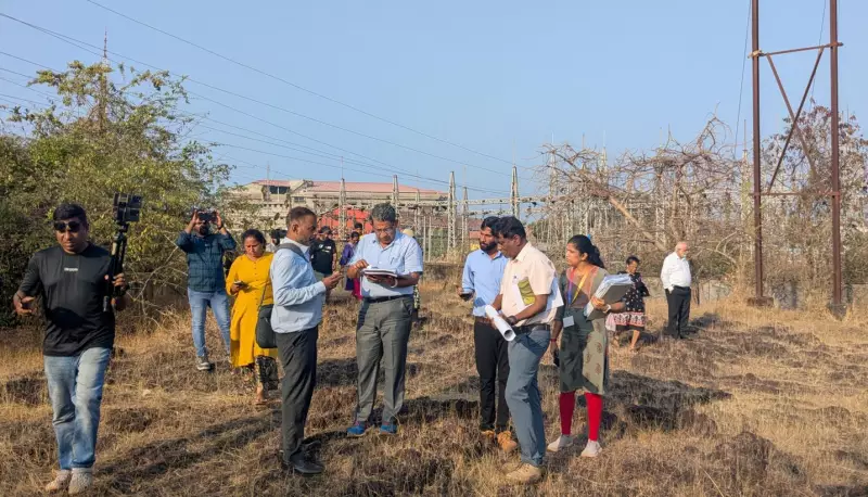
Led by Pramod Badami, a former chief engineer of the Water Resources Department (WRD), the multidisciplinary team comprising experts from various government departments has meticulously covered the designated catchment and wetland zones. "The survey is almost done, but there are some areas that we are not certain about. Those doubts will be cleared in the morning," Badami stated, highlighting the thoroughness of the ongoing efforts.
He further elaborated that the mapping process has comprehensively addressed all aspects requested by the Chimbel villagers, who have expressed satisfaction with the progress so far. "We covered all aspects. Villagers are satisfied with the mapping so far. We will calculate the total wetland area based on the mapping done," Badami confirmed. The final report detailing the findings is scheduled to be submitted to the government on Wednesday.

Community Involvement and Project Opposition
The survey was initiated in response to persistent demands from Chimbel residents to redefine the zone of influence afresh, particularly concerning two contentious government projects that surveyors contend fall within this sensitive area. Ajay Kolekar, a functionary of the Revolutionary Goans Party and an active participant in the protests against these projects, acknowledged the collaborative approach of the survey team.
"The government's survey team consulted our experts and kept us informed," Kolekar remarked, noting their contentment with the catchment area mapping completed to date. He added, "A small portion that falls in the land earmarked for Unity Mall will be inspected tomorrow." Despite this progress, Kolekar reiterated the community's unwavering stance, emphasizing that they have not relinquished their demand to scrap both projects entirely.
Implications and Next Steps
This landmark survey underscores the growing emphasis on environmental accountability and community engagement in developmental planning across Goa. The meticulous mapping of Toyyar Lake's wetlands not only serves to delineate ecological boundaries but also sets a precedent for transparent governance in project assessments.
As the remaining one percent of the survey area is finalized on Wednesday, stakeholders await the official report, which will play a crucial role in future decision-making processes regarding land use and conservation in the region.