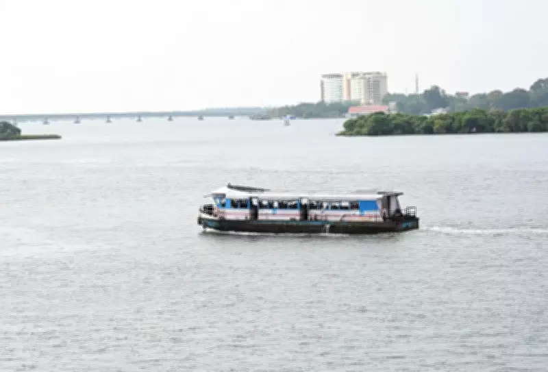
A recent study conducted by the Kerala University of Fisheries and Ocean Studies (Kufos) has revealed that the depth of North Vembanad Lake in Ernakulam district has decreased by more than 50% over the past 95 years. Researchers surveyed a 32-kilometer stretch of the lake from Bolgatty to Munambam to assess the underwater depth of the waterbody. Experts warn that this significant reduction in depth has severely diminished the lake's water-holding capacity, resulting in deteriorating water quality, weakened flow dynamics, an increased risk of flash flooding, and serious threats to the ecosystem and the livelihoods that depend on it.
Study Methodology and Findings
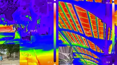
The study divided the surveyed stretch into two segments: Bolgatty to Cherai and Cherai to Munambam. In the Bolgatty-Cherai stretch, the lake’s depth ranged between 3 meters and 4.5 meters in 1930. By 1983, it had dropped to 2–2.5 meters, and by 2026, it further declined to just 1.2 meters—a reduction of more than 50% over 95 years. The Cherai-Munambam stretch recorded an average depth of 3 to 6 meters in 1930, which fell to 2.5–4 meters by 1983, and further to an average of 1.75 meters by 2026. The worst depletion was observed in the Cherai and Kuzhupilly sub-sectors, where depths have fallen to less than 1 meter.
To conduct the study, Kufos collaborated with the state government’s hydrographic survey wing, deploying echo-sounding apparatus to measure lake depths across the surveyed stretch. North Vembanad Lake receives water from the Periyar and Chalakudy rivers before discharging it to the sea through the Kochi and Munambam barmouths.

Implications for Flood Risk
V N Sanjeeven, professor chair of the centre for aquatic resource management and conservation at Kufos, emphasized the urgency of understanding the lake’s shrinkage in the context of flood risk. “The 2018 floods mostly affected people living on both sides of the Periyar and Chalakudy rivers. We need to understand how the reduction in the lake’s depth, which receives water from both rivers, will impact lives when a flood situation emerges,” he said. Sanjeeven attributed the declining depth primarily to man-made disruptions affecting water flow. Rivers naturally carry sediment into the lake, but when obstructions reduce flow velocity, sediment settles on the lakebed rather than being carried further. “Encroachments, bridges, and debris deposits accelerate sediment accumulation by restricting water flow,” he explained.
Future Research Plans
Kufos now plans to extend its research to assess how much the lake’s surface area has shrunk over the same period, measure current discharge levels from the feeder rivers, and evaluate the lake's present storage capacity. The findings are intended to help identify the reasons for flooding and propose effective mitigation measures.