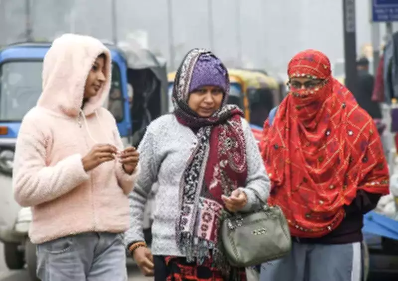
Kanpur Grapples with Unrelenting Cold Wave as Weather Conditions Worsen
The cold wave gripping Kanpur city and its division shows no signs of abating, with residents facing cloudy skies, moderate winds, and a further drop in temperatures expected even during daytime hours. According to the India Meteorological Department (IMD), a fresh western disturbance has become active over Himachal Pradesh and Uttarakhand, influencing weather patterns across northern India.
IMD Forecast Predicts Heavy Rainfall and Temperature Plunge
As a result of this western disturbance, heavy rainfall is once again likely across Uttar Pradesh between January 31 and February 1. The IMD has indicated that minimum temperatures are set to fall across most parts of the country over the next two days, leading to intense cold conditions that will affect daily life and activities.
Recent Weather Patterns in Kanpur
Kanpur witnessed dense fog during the intervening night of January 30 and 31, followed by a noticeable drop in temperature that resulted in a particularly cold day on Saturday. The minimum temperature fell to 9.7 degrees Celsius from 11.6 degrees Celsius recorded on January 30, though it remained 3.3 degrees above the normal level for this time of year.

The maximum temperature was recorded at 18.5 degrees Celsius, with maximum relative humidity touching 93 percent. North-western winds blew at speeds ranging between 6.1 and 8.3 kilometers per hour, contributing to the chill factor experienced by residents.
Expert Analysis and Future Predictions
Weather expert S Sunil Pandey of CSA University provided insights into the developing situation. He noted that due to cloud movement over the Kanpur division, mild sunshine may be witnessed in the coming days, offering temporary relief from the overcast conditions.
Pandey added that strong winds will prevail across Uttar Pradesh, including the Kanpur division, causing temperatures to fluctuate by 1 to 3 degrees. He issued a warning that continuous winds will make nights even chillier, with speeds potentially touching 9 kilometers per hour, and hailstorms possible in some areas of the region.
The weather expert also forecast drizzle or light rain in Kanpur division between February 2 night and February 3, suggesting that the precipitation might temporarily alter but not necessarily improve the cold conditions.
Transport Disruptions Due to Dense Fog
Meanwhile, dense fog significantly disrupted rail services in and around Kanpur, with all trains passing through or arriving in the city running behind schedule. The Kanpur–New Delhi Shatabdi Express, which was scheduled to reach at 8:40 pm on January 30 on its return journey, arrived around 4:26 am the following morning, delayed by nearly eight hours.
Several other trains were delayed by multiple hours due to poor visibility conditions caused by the persistent fog, affecting commuters and travelers across the region. The transportation disruptions highlight the broader impact of the severe weather conditions on infrastructure and daily routines.
Broader Implications of the Cold Wave
The extended cold wave in Kanpur represents part of a larger weather pattern affecting northern India during this winter season. Residents are advised to take necessary precautions against the cold, including wearing appropriate clothing and minimizing exposure during peak cold hours.
Agricultural activities, transportation schedules, and outdoor work may face continued challenges as the weather system develops further over the coming days. The combination of low temperatures, wind chill, and potential precipitation creates a complex weather scenario that requires careful monitoring and adaptation by both authorities and citizens.