India Faces Unsettled Weather Pattern with Thunderstorms and Temperature Swings
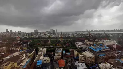
The India Meteorological Department (IMD) has issued a significant weather bulletin, indicating a period of unsettled conditions across multiple regions of the country. Over the coming days, parts of eastern, central, and southern India are likely to experience thunderstorms, lightning, and gusty winds, driven by atmospheric disturbances.
Key Weather Systems and Affected Regions
According to the IMD update released on February 23 at 07:45 pm, a low-pressure area over the Bay of Bengal is the primary influence, interacting with upper-air circulations and troughs. This system is expected to bring short spells of rain, thunderstorms, and strong winds to specific areas within the next 24 to 48 hours.
Regions under immediate watch include:

- Odisha, Jharkhand, West Bengal, Assam, and Meghalaya in eastern India
- Chhattisgarh, Madhya Pradesh, Telangana, and Vidarbha (Maharashtra) in central and southern India
- The Andaman & Nicobar Islands, which may see thunderstorms with strong winds
Isolated thunderstorm activity with lightning is particularly likely on February 24 over Assam & Meghalaya, Chhattisgarh, Madhya Pradesh, Sub-Himalayan West Bengal & Sikkim, Telangana, and Vidarbha. Importantly, the IMD notes that this is not expected to escalate into a major storm or cyclone, as the low-pressure system is anticipated to weaken within 24 hours.
Temperature Trends and Weekly Outlook
The weather bulletin also highlights notable temperature fluctuations across different parts of India:
- Northwest India: A gradual rise in maximum temperatures by 2–3 degrees Celsius is forecast over the next four days, with stable conditions thereafter.
- Vidarbha and Chhattisgarh: These regions may see a drop in maximum temperatures by around 2 degrees Celsius in the next three days, followed by a gradual increase of 2–3 degrees Celsius.
- Other Areas: No significant changes in maximum temperatures are expected elsewhere.
Looking ahead, thunderstorm activity is projected to remain confined largely to eastern, central, and island regions in the immediate term. Weather conditions across most of northern and western India are expected to stabilize after February 26, with scattered rainfall possible in parts of Jammu & Kashmir, Himachal Pradesh, Uttarakhand, Kerala, Mahe, Arunachal Pradesh, and Lakshadweep from around that date.
Travel Advisory and Safety Precautions
Travelers planning visits to the affected regions should prepare for potential disruptions:
- Eastern and Central India: Be ready for short spells of rain, thunderstorms, lightning, and sudden gusty winds over the next one to two days, which could lead to flight delays, slower road traffic, and reduced visibility.
- Andaman & Nicobar Islands: Thunderstorms and strong winds may temporarily affect boat rides, ferries, and water activities.
- Hill Stations: From around February 26, light rain or snowfall may impact parts of Jammu & Kashmir, Himachal Pradesh, and Uttarakhand; visitors should carry warm clothing and check local road conditions.
Residents in prone areas are advised to stay alert, especially during lightning and gusty wind events, as the transition toward pre-summer conditions appears gradual rather than abrupt.