India prepares for a significant weather shift between January 19 and 24, 2026. Two western disturbances will sweep across northern regions in quick succession. The All India Weather Summary and Forecast Bulletin issued on January 18 details these changes. Expect widespread rainfall, snowfall, dense fog, cold waves, thunderstorms, and a gradual temperature rise in several states later in the period.
Western Disturbances to Impact Northwest India
Meteorologists confirm two western disturbances will affect northwest India. The first begins on the night of January 19. The second follows from January 21. These systems will intensify precipitation over the Western Himalayan Region. Their influence will later extend to adjoining plains. Interaction with cold air will sustain cold wave and fog conditions early in the forecast period.
Rainfall and Snowfall in Northern Areas
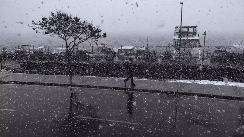
The Western Himalayan Region and Himachal Pradesh will see isolated to scattered light to moderate rainfall and snowfall from January 19 to 21. Activity intensifies from January 22 to 24. Fairly widespread to widespread precipitation is forecast then. On January 23, isolated heavy rainfall and snowfall can occur in these regions. Travelers to Himachal Pradesh should check daily weather forecasts. Snowfall may cause travel disruptions and temporary closure of mountain passes.

Uttarakhand will also experience increased precipitation. Rainfall and snowfall remain isolated on January 21 and 22. It becomes fairly widespread on January 23 and 24. Thunderstorm activity with lightning is likely over Uttarakhand during this period, especially on January 23 and 24.
IMD Weather Forecast for Plains
In the plains, isolated to scattered light to moderate rainfall is likely over Punjab, Haryana, Chandigarh, Uttar Pradesh, and Rajasthan from January 22 to 24. These rains may relieve persistent dry conditions. They could also disrupt road and rail traffic in urban and semi-urban areas.
Thunderstorms and Lightning Activities
Thunderstorm activity will accompany precipitation in several regions. On January 22 and 23, thunderstorms with lightning are likely at isolated places over Punjab, Haryana, Chandigarh, Delhi, and Rajasthan. Uttarakhand will likely experience thunderstorm activity on January 23 and 24. Authorities advise caution during these periods for outdoor activities, agricultural operations, and travel.
Fog and Cold Conditions Persist Initially
Dense fog remains a major concern early in the forecast period. On January 19, dense to very dense fog is very likely in some parts of Uttar Pradesh. Dense fog conditions may persist in isolated pockets until January 20. Dense fog is also forecast at isolated places over Bihar, Haryana, Chandigarh and Delhi, Punjab, sub-Himalayan West Bengal and Sikkim, and West Rajasthan.
On January 20, dense fog conditions are very likely at isolated places over Bihar, Haryana, Chandigarh and Delhi, and Punjab. Isolated pockets over Delhi and sub-Himalayan West Bengal and Sikkim will also see effects. Fog conditions gradually ease by January 21. However, isolated to some pockets of dense fog may still occur over Punjab, Haryana, Chandigarh, and Bihar.
Cold wave conditions are very likely at isolated places over Himachal Pradesh from January 19 to 21. Odisha may also experience isolated cold wave conditions on January 19. Additionally, cold day conditions are very likely in some pockets of Uttar Pradesh on January 19 and 20. This increases health risks for vulnerable populations.
Gradual Warming Expected
Cold conditions dominate early days, but minimum temperatures will rise gradually in many regions toward the period's end. Over northwest India, minimum temperatures show no significant change from January 19 to 22. A rise of 3 to 5 degrees Celsius follows during January 23 to 25.

Maharashtra expects no significant change in minimum temperatures until the evening of January 19. Temperatures likely rise by 2 to 4 degrees Celsius between January 20 and 23, with no major change thereafter. Gujarat and east India will experience a gradual rise of 2 to 3 degrees Celsius from January 19 to 21. Stable conditions follow through January 25. Central India may also see a gradual rise of 2 to 3 degrees Celsius from January 23 onwards. For the rest of the country, no significant change in minimum temperatures is expected during this period.
Looking Ahead to January 25-27
Scattered to fairly widespread rainfall and snowfall will likely continue over the western Himalayan Region, Punjab, Haryana, and Delhi. Isolated to scattered rainfall is expected over west Uttar Pradesh. Isolated rainfall is forecast over Lakshadweep and the Nicobar Islands. Unsettled weather conditions may persist beyond the current forecast window.
Public Advisory on Health and Transport
Dense fog conditions may significantly affect transport and aviation services, as well as power infrastructure. Reduced visibility can disrupt road, rail, and air traffic. Authorities advise the public to drive carefully using fog lights. Check travel schedules before commuting. Avoid unnecessary outdoor exposure.