California is grappling with a severe weather crisis as another powerful storm system brings heavy rain and a high risk of flash flooding, forcing extended evacuations and disrupting holiday travel. Authorities in Los Angeles County have prolonged evacuation orders, warning residents of extreme danger on the roads during this busy festive period.
Storm Details and Immediate Threats
A final band of moderate to heavy rain is sweeping across California on Friday, posing a serious threat of flash floods from Oxnard to Los Angeles, as reported by the National Weather Service (NWS). Southern coastal areas are also bracing for strong winds and potential thunderstorms.
The NWS has issued a flash flood warning effective until noon local time Friday, stretching from Malibu to West Hollywood. In response, the Los Angeles County Sheriff's office has extended evacuation orders for vulnerable areas until 1 p.m. local time. The storm's impact is widespread, with over 50,000 homes and businesses left without power on Friday morning, primarily in Northern California, according to data from PowerOutage.us.
Emergency services have been stretched thin, with the Los Angeles Fire Department conducting a helicopter rescue for a woman who was swept into a stormwater channel on Friday.
Travel Chaos and Long-Term Risks
The relentless downpour has crippled Christmas holiday travel across the state. Major freeways are waterlogged, flights are delayed, and dozens of roads in the LA area are closed due to flooding, fallen trees, storm damage, debris, and mudslides. These disruptions are echoed statewide.
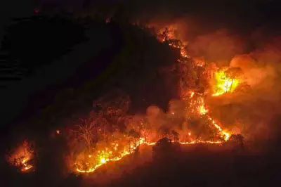
The situation is particularly perilous in regions scarred by massive wildfires roughly a year ago. The burnt vegetation has left the soil hydrophobic, meaning it repels water instead of absorbing it. This dramatically increases the risk of dangerous landslides, mudslides, and further power outages.
"Those soils are still hydrophobic, which means that rain just runs off like it’s hitting hard dirt or concrete," explained Scott Kleebauer, a meteorologist at the Weather Prediction Center. He noted that such burn scars can persist for four to five years before showing any improvement, meaning this vulnerability will remain for the foreseeable future.
Record Rainfall and Mountain Impacts
The historic rains, driven by Pacific weather systems known as atmospheric rivers, have already claimed at least three lives this week. Downtown Los Angeles recorded more than 3 inches of rain in the three days leading to Friday morning. The Christmas Eve-Christmas Day period saw the most rain since 1971, ranking as the fourth wettest two-day holiday period in records dating back to 1877.
The heaviest precipitation has targeted mountain regions. More than 6 inches (15 centimeters) of rain drenched Mount Baldy and Mount San Antonio, triggering mudslides in Wrightwood near the area of the 2024 Bridge Fire. In the ski resorts, Mammoth Mountain expects 12 to 18 inches of new snow with high winds, while Heavenly Lake Tahoe has already received 31 inches in 48 hours. The NWS warns of "near white out conditions" in the mountains, making travel extremely hazardous.
Forecasters indicate that after this final band of storms passes on Friday, conditions should gradually begin to ease, offering some respite to the battered state.


