Hubballi-Dharwad Municipal Corporation Launches High-Precision Geospatial Infrastructure
The Hubballi-Dharwad Municipal Corporation (HDMC) has taken a significant step toward modernising urban governance by establishing two Continuously Operating Reference Stations (CORS) in the twin cities. This initiative aims to build a robust, high-precision geospatial infrastructure that will fundamentally transform how spatial data is collected and utilised for municipal operations.
Enhancing Accuracy and Reliability in Municipal Planning
The newly installed CORS network is designed to strengthen the accuracy and dependability of spatial information used across various municipal functions. By creating a stable reference framework for positioning, the system ensures that all Geographic Information System (GIS) surveys and mapping outputs from different departments adhere to a single, consistent standard. This alignment is crucial for reducing mismatches between datasets and improving overall data quality, which directly impacts service delivery and day-to-day government operations.
Supporting Digital Governance and Urban Modernisation
This initiative is a key component of HDMC's broader digital governance and urban modernisation agenda. In today's rapidly evolving urban landscapes, reliable geospatial data has become increasingly central to informed decision-making. With the CORS in place, municipal teams and authorised surveyors can achieve significantly improved positional accuracy for critical tasks such as field measurements, asset mapping, and infrastructure documentation.

Practical Applications and Benefits
The implementation of CORS is expected to enhance the precision of base maps and thematic layers used for managing essential civic assets. This includes:
- Roads and transportation networks
- Drainage and sewage systems
- Water supply lines and distribution networks
- Streetlight installations and maintenance
- Property boundaries and land records
Furthermore, the system enables better integration of new survey work with existing GIS records, minimising duplication and errors that typically arise when different reference points are used for various surveys.
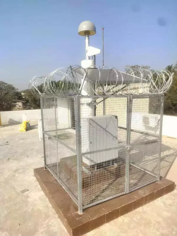
Infrastructure Details and Operational Timeline
Each CORS station was set up at a cost of Rs 45 lakh, with installations completed in both Hubballi and Dharwad at HDMC-owned buildings. Placing these stations on municipal property ensures secure access, controlled maintenance, and long-term operational stability. According to R Vijay Kumar, superintending engineer, the stations were established by an NCR-Delhi-based company and are expected to become operational within the next 20 days.
Future Implications and Advanced Applications
Once fully active, the CORS network will provide a dependable foundation for future GIS upgrades and more advanced applications. This infrastructure represents a forward-looking investment in urban management technology that will support the twin cities' growth and development for years to come. The enhanced geospatial capabilities will facilitate more efficient resource allocation, better infrastructure planning, and improved public service delivery across Hubballi and Dharwad.