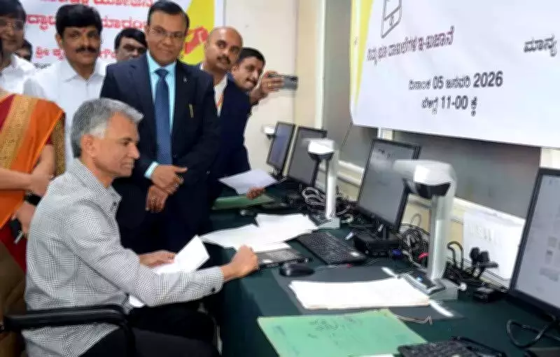
Bengaluru's Land Records to Achieve Full Digital Transformation by 2026
In a significant stride toward enhancing governmental transparency and operational efficiency, the Survey, Settlement and Land Records (SSLR) wing of Bengaluru's revenue department has announced a comprehensive plan to digitize its entire workflow. This ambitious initiative will empower citizens to manage land-related processes entirely online, eliminating the need for physical visits to government offices.
Online Platform to Revolutionize Land Management
Officials have confirmed that the digitization project is scheduled for completion by the end of 2026. Once fully implemented, the new digital system will allow applicants to submit survey requests, monitor application status in real-time, and download official documents from any location. Venkat Raja, SSLR Commissioner, emphasized that this move is designed to drastically reduce processing delays, eliminate intermediary involvement, and effectively curb corruption within the department.
Currently, the SSLR department handles an overwhelming volume of between 100,000 and 120,000 survey applications each month from both private citizens and various government agencies. The digitization effort aims to streamline this high-demand service, making it more accessible and user-friendly for all stakeholders.

Preserving and Modernizing Historical Records
The department has already undertaken the scanning of numerous survey documents, some of which originate from the British colonial era. However, a substantial challenge remains with older records, including akarbands and land extent measurements, which are often in non-readable formats. Many entries, particularly numerical data, are recorded in regional languages such as Marathi.
As part of the digitization drive, these historical records will be meticulously converted into accessible digital formats. Accurate land measurements will be extracted from original 'tippanis'—critical survey documents that document physical measurements and property boundaries. This data will then be integrated into advanced geospatial digital revenue maps to enhance precision and reliability.
Advanced Technology and Legal Enforcement
"We are deploying rover equipment to conduct digital surveys, which will accelerate the process and ensure more accurate boundary demarcations," Commissioner Raja explained. "Additionally, we are creating a Unique Land Parcel Identification Number (ULPIN) for every property to prevent future legal disputes."
Raja also addressed existing legal frameworks, noting that an Act already prohibits the subdivision of agricultural land below five guntas. Despite this regulation, some individuals continue to attempt illegal subdivisions. The department has issued strict instructions to officials to reject any such unauthorized proposals, reinforcing compliance with land-use laws.
Interdepartmental Collaboration and Environmental Protection
The ULPIN-integrated digital maps will be shared with multiple government departments, including urban and rural development, panchayat raj, and forest authorities. These comprehensive maps will incorporate river and lake buffer zones, enabling authorities to swiftly identify and block illegal proposals for layouts, industrial projects, or other developments in ecologically sensitive areas.
This holistic approach not only modernizes land administration but also supports environmental conservation efforts, ensuring sustainable urban and rural planning across the region.